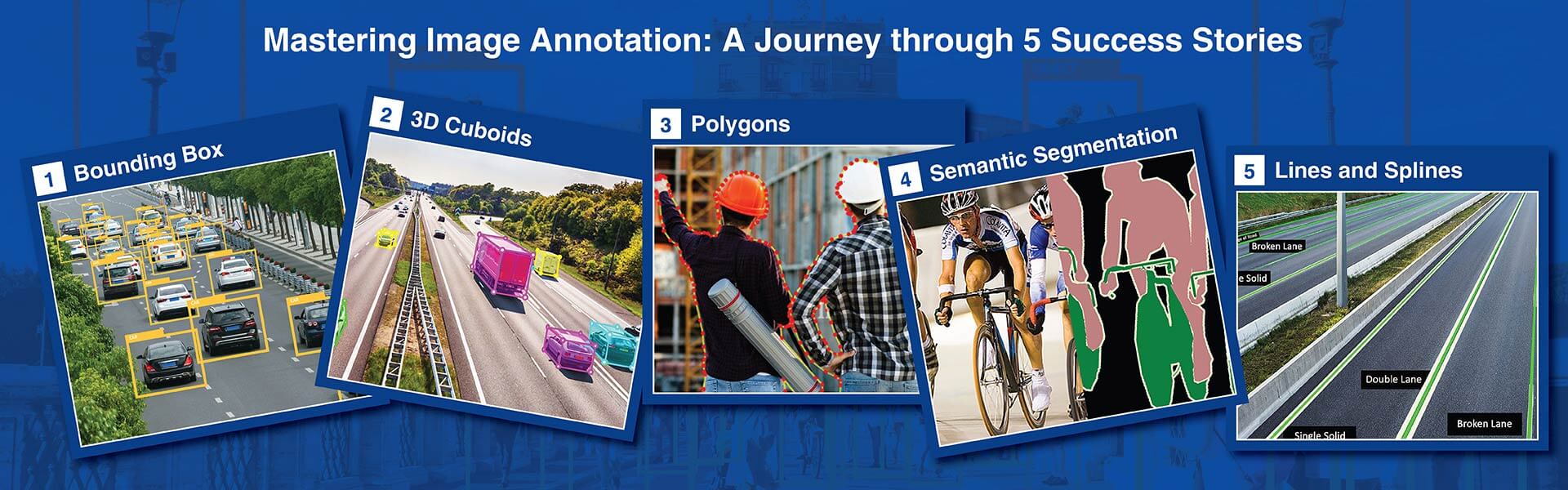
Polygon annotation traces multi-vertex outlines around each object's true boundary, capturing irregular shapes that bounding boxes cannot. HabileData delivers polygon annotation services achieving 93%+ mean IoU accuracy across standard object classes, validated through a three-stage QA process covering vertex placement, closure accuracy, and inter-annotator agreement on every annotated instance.
Get started with a free trial now »
Your computer vision model is only as reliable as its training polygons. Misplaced vertices compound across thousands of images, teaching imprecise boundaries as ground truth.
This hidden accuracy drain is exactly why leading AI companies outsource polygon annotation services to HabileData. Our annotation guidelines specify minimum vertex counts per object class, ensuring complex concave and convex contours are captured with full geometric fidelity. We also enforce maximum permissible pixel deviation from the true object boundary.
Minimum vertex counts and pixel deviation limits – specified per object class
Our annotation guidelines specify minimum vertex counts per object class, ensuring complex concave and convex contours are captured with full geometric fidelity. We enforce maximum permissible pixel deviation from the true object boundary and define explicit edge ownership rules for adjacent annotated regions.
SAM and CVAT intelligent scissors generate outlines – annotators refine to sub-pixel
AI-assisted tools including SAM, Labelbox segment-anything, and CVAT intelligent scissors generate initial outlines that annotators refine. They correct over-smoothed convex approximations where concave indentations exist, recovering missed boundary details at sub-pixel precision — the human layer that automation alone cannot deliver.
Manual vertex placement for tumour margins, crop boundaries, and reflective surfaces
For complex objects where automation struggles – tumour margins, blended crop boundaries, or reflective industrial components with mixed concave and convex geometries – our team applies manual vertex placement. Every delivered polygon clears three-stage validation covering vertex accuracy, closure integrity, and inter-annotator agreement on contested boundaries.
Standards refined across hundreds of projects – AV, medical, and geospatial
These production-grade standards are refined across hundreds of delivered projects for autonomous vehicle, medical imaging, and geospatial companies. When annotators misplace vertices by even a few pixels, that error compounds across thousands of images. Our standards exist to prevent that compounding before it reaches your training pipeline.
We deliver the full range of polygon annotation capabilities across image, video, geospatial, and medical data. Each service below is described with the technical detail your ML team needs to evaluate compatibility with your model architecture.
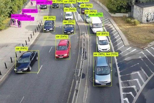
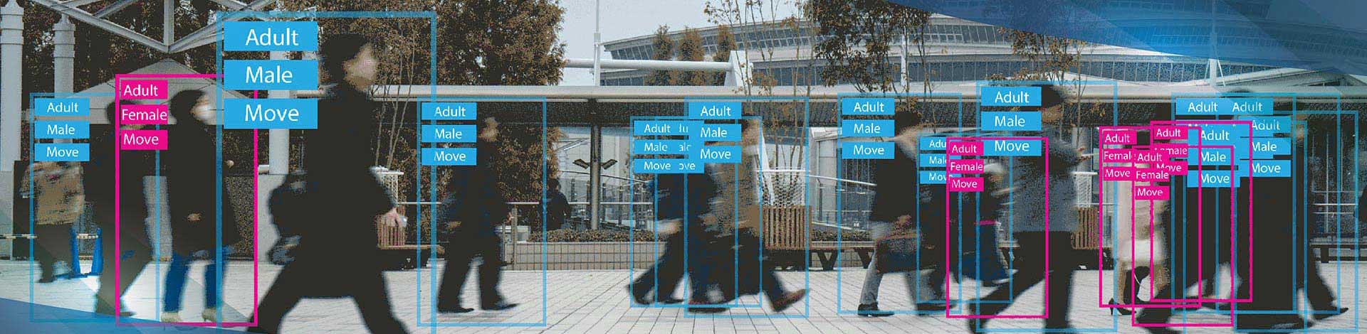
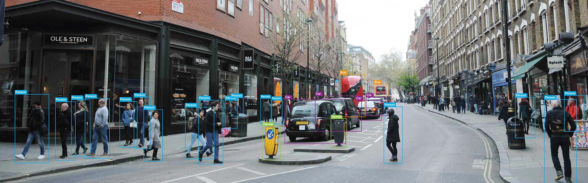
Polygon outlines around irregular objects with class labels and attribute metadata per polygon. Used to train instance segmentation models (Mask R-CNN, SOLOv2, QueryInst) that detect and segment irregular-shaped objects. Concave polygon support for objects with non-convex boundaries. Vertex count guidelines per object class defined before annotation begins.
Polygon annotation for land parcel boundaries in satellite imagery, building footprint extraction, agricultural field delineation, and land use classification. GPS coordinate output with GIS pipeline compatibility. Attribute labels per region (land use type, crop type, administrative class). Used for geospatial AI, precision agriculture, and urban planning systems.
Polygon annotation on images for 3D object reconstruction and augmented reality applications. Object contours annotated with precise polygon boundaries enabling 3D mesh generation from 2D image-derived geometry. Used for AR product visualization, 3D asset creation pipelines, and mixed reality experience development.
Frame-by-frame polygon annotation with consistent instance IDs across video sequences and temporal consistency validation to ensure polygon boundaries do not drift between adjacent frames on objects that have not changed position. Used for video instance segmentation model training and detailed object tracking datasets.
Annotating pre-recorded and live video stream of vehicles provided training data for machine learning models for a California based data analytics company helped managing traffic efficiently.
Read full Case Study »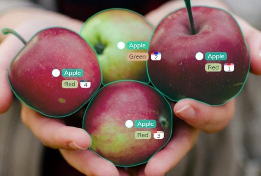
The food images to be labelled and categorized so that the client could use them as training data for accurate interpretation of visual data through data annotation.
Read full Case Study »
Capture, validate and verify information on upcoming or existing construction projects from multi-lingual and multi-format online publications across Europe and USA.
Read full Case Study »
Every delivery includes a quality report with IoU scores per class, annotator-level performance metrics, and class distribution analysis. You can verify our accuracy claims against your own ground truth data using the free pilot project.
Our 300+ annotators are organized into domain-specific teams for autonomous driving, medical imaging, geospatial analysis, and retail. Each team receives ongoing training on domain-specific annotation challenges, edge-case handling, and quality benchmarks relevant to their specialization.
We process 10,000+ images per day for polygon annotation projects. When your volume increases, we scale team size within 48 hours using pre-qualified annotators from our bench. Quality metrics remain consistent across scale because every new annotator passes the same project-specific qualification test.
Your data is protected by ISO 27001-certified infrastructure, AES-256 encryption at rest and in transit, NDA signed for every engagement, and HIPAA/GDPR-compliant workflows for regulated industries. We support on-premise annotation for clients who require data to remain within their own infrastructure.
Polygon annotation pricing depends on object complexity (vertex count), object density per image, class count, and quality tier. We provide detailed per-image and per-object pricing after reviewing your sample data. There are no setup fees, no minimum commitments, and no hidden costs for format conversion or delivery.
A dedicated team of 20 annotators can process 10,000 images with polygon annotations in 5–7 business days. Our three-shift operation across time zones means annotation work continues around the clock, delivering turnaround times that are typically 3X faster than building and managing an in-house annotation team.
Polygon annotation is the right annotation technique whenever the target AI model needs to understand object shape, not just object location. The industries below represent the primary applications, each with distinct annotation requirements and annotator domain knowledge needs.


Use polygon annotation when the shape of the object is meaningful for your model’s task – when the model needs to learn not just where an object is but what shape it is. Medical imaging (tumour boundaries), agricultural field mapping (crop plot outlines), satellite imagery (building footprints), and instance segmentation (individual object masks for downstream tasks like AR, 3D reconstruction, or visual search) all require polygon precision. Use bounding boxes when you only need to locate and classify objects and shape precision is not required.
Minimum vertex count depends on the object class and required boundary precision. Circular or curved objects (tumours, spherical products) require more vertices than angular objects (buildings, rectangular parts). Our annotation guidelines specify the minimum vertex count per class — typically 6–8 for rounded objects and 4–6 for roughly rectangular objects with corner imprecision. Over-vertexing (too many vertices) can introduce noise; under-vertexing (too few) reduces IoU. Our guideline specifies the right minimum per class.
COCO instance segmentation JSON (polygon stored as array of xy coordinates), Pascal VOC XML (polygon in object segmentation format), GeoJSON (geospatial polygon with coordinate reference system), DICOM annotation format (medical imaging), ESRI shapefile (GIS applications), and fully custom schema. For instance segmentation, we also deliver RLE-encoded masks (run-length encoding — the standard COCO storage format for large masks).
Yes. We annotate overlapping objects (where one object partially occludes another) using layer-based polygon annotation that preserves both objects’ boundaries independently. Nested polygon annotation (e.g., a defect region inside a component boundary) is handled with parent-child polygon relationship annotation in COCO panoptic format or custom nested JSON.
SAM (Segment Anything Model) generates a polygon mask for any object given a prompt (a point or bounding box inside the object). The resulting mask is converted to a polygon outline that the annotator reviews, adjusts, and approves. For clearly bounded objects (products on white backgrounds, buildings from aerial imagery, large medical structures), SAM generates high-quality outlines that need minimal correction — producing 50–70% faster annotation. For complex or poorly bounded objects, manual annotation with the SAM outline as a reference guide is applied.
Disclaimer: HitechDigital Solutions LLP and HabileData will never ask for money or commission to offer jobs or projects. In the event you are contacted by any person with job offer in our companies, please reach out to us at info@habiledata.com.